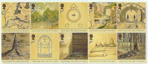
Stamps with Tolkien's drawings
|
|
Stamp set issued on 26th February 2004 by the Royal Mail |
|
|
|
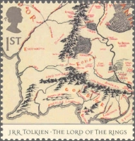
Map from the Lord of The Rings Map of areas of Middle-earth, drawn by Christopher Tolkien |
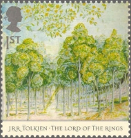
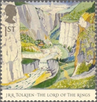
The Forest of Lothlórien The forest lay east of the Misty Mountains. Galadriel and Celeborn were the rulers there More about the original picture |
|
|
|
|
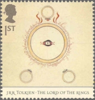
The Fellowship of the Ring Part one of The Lord of the Rings. Cover illustration by J.R.R. Tolkien More about the original picture |
Rivendell The hidden refuge which Elrond the Half-elven founded in the middle of the Second Age More about the original picture |
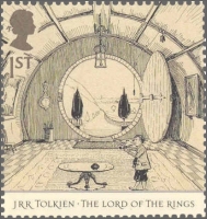
The Hall at Bag-End The home of Bilbo Baggins (and later of Frodo) More about the original picture |

|
|
|
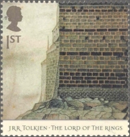
Orthanc The tower where Saruman the Wizard lived and gathered an army of uruk-hai |
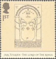
Doors of Durin The west entrance to Moria. The doors could be opened by the word 'mellon', which means friend More about the original picture |
|
|
|
|
Barad-Dur Sauron's dark tower in Mordor. Its foundations were laid by the help of the power of the Ring More about the original picture |
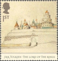
Minas Tirith The seven-tiered citadel of the Kings of Gondor. This city had been the capital of Gondor for many years More about the original picture |
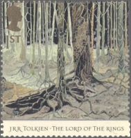
Fangorn Forest The forest bore the same name as Fangorn the Ent, better known as Treebeard (which is the meaning of the name) More about the original picture |
Other graphics credited to aks.

Anne K. Sorknes 
To main menu list 
To previous level:
Literature